

Digital Transformation Is Reshaping the Future of Engineering Projects
With the rapid expansion of infrastructure and smart city projects across the Kingdom of Saudi Arabia, the integrated management of engineering and geospatial data has become one of the key factors for project success.
Modern projects no longer rely solely on high-quality design. Instead, they require a comprehensive approach that connects detailed building information with the surrounding environment, enabling accurate decision-making throughout every stage of the project lifecycle.
In this context, the integration of Building Information Modeling (BIM) and Geographic Information Systems (GIS) represents a significant advancement in planning, design, construction, and asset management. By combining detailed engineering data with geospatial information within a unified platform, organizations can improve efficiency, reduce risks, and enhance project sustainability.
What Is the Difference Between BIM and GIS, and Why Is Their Integration Essential?
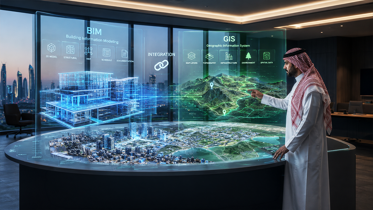
Although each technology serves a different purpose, integrating BIM and GIS creates a comprehensive digital ecosystem that supports the entire project lifecycle, from initial feasibility studies through operation and maintenance.
Building Information Modeling (BIM)
Building Information Modeling (BIM) provides an advanced digital environment for creating intelligent 3D models enriched with engineering data. These models include structural, architectural, mechanical, and electrical components, along with operational information required for efficient lifecycle management of facilities.
Beyond generating a three-dimensional model, BIM serves as a centralized engineering database that enables design teams, contractors, and project managers to coordinate effectively and make more informed decisions.
Geographic Information Systems (GIS)
GIS is a specialized system for managing and analyzing geospatial data, linking engineering information with geographic locations and surrounding environmental factors such as terrain, road networks, infrastructure, land use, and utility networks.
This provides project teams with deeper insights into the factors influencing the project before and during construction, improving planning accuracy and reducing potential risks.
How Does BIM-GIS Integration Deliver Real Value to Projects?
By integrating engineering models with geospatial data, projects become digitally connected to their real-world environment rather than existing as standalone models. This delivers several strategic advantages, including:
- More Accurate Planning: Integrating engineering and geospatial data provides a comprehensive understanding of the project site, enabling better design decisions before construction begins.
- Improved Coordination and Fewer Conflicts: Connecting engineering models with infrastructure networks helps reduce construction conflicts, errors, and costly modifications during execution.
- More Efficient Decision-Making: Unified data provides accurate information that supports design, construction, and risk management while improving operations and asset management after project completion.
- Reduced Time and Costs: Early identification of potential challenges minimizes redesign, optimizes resource utilization, accelerates project delivery, and lowers overall costs.
The Role of BIM and GIS Integration in Smart Cities
Smart cities rely on seamless data exchange across multiple systems. The integration of BIM and GIS is one of the key digital enablers of this transformation, providing a unified model that connects buildings, infrastructure, and the surrounding environment.
This enables asset owners and developers to manage infrastructure more efficiently, improve urban planning processes, support sustainability initiatives, and enhance the quality of services delivered to communities.
Al Qotr’s Role in Delivering Integrated Digital Solutions
Drawing on its extensive expertise in geospatial data and engineering consultancy, Al Qotr adopts the latest international best practices in integrating BIM and GIS technologies within a unified digital framework that supports every stage of the project lifecycle.
The company integrates engineering models with geospatial data using advanced digital platforms, enabling clients to gain a comprehensive project perspective, improve planning efficiency, enhance construction quality, and manage assets according to the highest engineering standards.
This approach reflects Al Qotr’s commitment to delivering advanced digital solutions aligned with the objectives of Saudi Vision 2030, contributing to smarter, more sustainable, and operationally efficient projects.