

Modern cities are undergoing a rapid transformation toward more connected models that rely on digital technologies for planning, operations, and asset management. In this context, Digital Twins have emerged as one of the advanced technologies redefining how the urban environment is understood and managed by creating an integrated digital representation that reflects the characteristics of real-world elements, facilities, and assets.
The effectiveness of a Digital Twin largely depends on the availability of accurate and reliable spatial data. Geospatial information provides the foundation that connects the location, geometry, characteristics, and spatial relationships of the various components of a city. When this data is integrated with Geographic Information Systems (GIS), 3D modeling, surveying, and aerial imagery, it becomes possible to create an integrated digital environment that helps understand the existing urban reality and simulate future scenarios before they are implemented in the real world.
As major urban and development projects continue to expand across Saudi Arabia, including NEOM and New Murabba, the importance of this digital ecosystem is increasing in supporting planning, project management, asset monitoring, and operational efficiency, in line with the Kingdom’s direction toward building more connected, resilient, and sustainable cities.
An Integrated Digital Representation of the Urban Environment (Digital Twin)
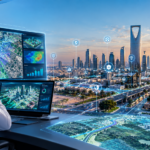
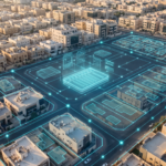
The concept of a Digital Twin goes beyond creating a 3D model of a building or city. It involves developing an interconnected digital representation of real-world elements, their characteristics, locations, and relationships, allowing changes to be monitored and different scenarios to be analyzed within a unified virtual environment.
This ecosystem begins with geospatial data that defines locations, dimensions, boundaries, and spatial relationships. This data is then integrated with engineering, operational, and other information associated with the asset or facility.
As a result, the digital model evolves from being merely a visual representation into an information-rich environment that can support the different stages of planning, construction, and operations.
The importance of this integration lies in providing a unified view of project components, helping stakeholders understand the current situation, compare different scenarios, and assess the potential impact of decisions before implementing them in the real world.
The Role of 3D Modeling in Understanding the Urban Environment
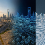
3D modeling is one of the key components in developing advanced digital environments, providing a more realistic representation of elements and facilities compared with traditional two-dimensional maps.
By integrating models of buildings, roads, utility networks, terrain, and surrounding elements, it is possible to create a comprehensive digital scene that represents the characteristics of a site more clearly. These models can support the study of urban expansion, analysis of relationships between facilities, and assessment of the impact of new projects on the surrounding environment.
3D models can also be used to visualize project development stages and compare existing conditions with future plans. This contributes to improving communication between design, construction, and management teams while providing a clearer visual and spatial basis for decision-making.
Scenario Simulation and Urban Planning Support
One of the most important capabilities of Digital Twins is their ability to simulate different scenarios within a virtual environment before they are implemented in the field.
These capabilities can be used to study the impact of urban changes, analyze traffic movement, evaluate service distribution, examine land use, and test scenarios related to emergency and disaster management.
For example, stakeholders can study the impact of constructing a new road on movement within a specific area, evaluate the distribution of new service facilities, or simulate the impact of an emergency scenario on a group of assets and infrastructure.
Such simulations enable decision-makers to compare alternatives and understand the potential outcomes of each option. This supports planning based on a comprehensive spatial perspective and reduces reliance on decisions based solely on theoretical assumptions.
Asset and Infrastructure Management Through a Unified Digital Environment
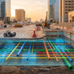
The value of Digital Twins extends into the operational and asset management stages, where spatial elements can be linked to their technical and operational information within an integrated database.
This enables the creation of a digital environment that provides access to asset information, locations, and characteristics, while allowing their condition to be monitored and updates throughout their lifecycle to be documented.
This environment can also support maintenance activities, priority setting, and monitoring changes occurring across facilities and infrastructure.
Through this approach, asset management becomes more closely connected to location and real-world conditions rather than relying on fragmented information distributed across multiple systems and files.
Geospatial Data: The Foundation of the Digital Twin
Regardless of the capabilities of a digital platform, the quality of a Digital Twin is directly linked to the quality of the data on which it relies.
Surveying, mapping, aerial imaging, and the production of spatial models therefore represent essential stages in developing a reliable digital environment.
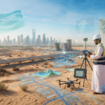
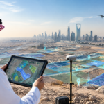
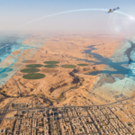
Technologies such as 3D laser scanning, aerial imagery, unmanned aerial vehicles (UAVs), and Geographic Information Systems (GIS) provide multiple sources for building an accurate spatial database that can be continuously updated as a project develops.
Integrating these sources into a unified spatial database creates a more comprehensive representation of the site and its components, increasing the value of the digital model and making it more suitable for planning, construction, and asset management applications.
Towards More Connected and Intelligent Saudi Cities
As major urban projects continue to develop across the Kingdom, the concept of smart cities is moving toward more integrated models that combine spatial data, digital models, operational systems, and asset information within a unified ecosystem.
Digital Twins represent one of the technologies that can contribute to achieving this integration by providing a virtual environment through which cities and their components can be understood as interconnected systems, scenarios can be analyzed, assets can be monitored, and urban planning can be improved.
The importance of this technology extends beyond its visual or technical aspects. It also supports operational efficiency, improves the utilization of data, and enhances long-term planning capabilities, in line with the development of digital infrastructure and the creation of more sustainable and resilient cities.
Alqotr: Building Geospatial Environments for Digital Cities
Amid the rapid transformation toward smart cities, accurate geospatial data represents one of the fundamental components for building reliable digital environments.
By combining geospatial expertise with advanced surveying and modeling technologies, Al Qotr develops solutions that support the creation of integrated spatial databases for use in urban projects, infrastructure, and asset management.
The company’s solutions include Geographic Information Systems (GIS), 3D laser scanning, aerial imaging, unmanned aerial vehicles (UAVs), and 3D modeling to produce accurate spatial data and digital environments that help represent sites, analyze their components, and connect spatial information with data associated with assets and projects.
This approach provides an integrated geospatial foundation that can support the development of Digital Twins and various project stages, starting from surveying and planning, through design and construction, and extending to operations and asset management.
By leveraging advanced geospatial technologies and developing integrated digital solutions, Al Qotr continues to support Saudi Arabia’s vision of developing smart cities and more connected urban environments, in alignment with the objectives of Saudi Vision 2030 and the growing role of spatial data in shaping a knowledge- and technology-driven urban future.