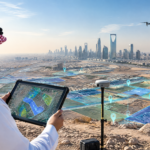



From Field Data to Decision-Making: The Geospatial Data Journey in Projects
Many geospatial projects begin with a simple question: How can we obtain accurate data about a site? However, the true value of data is not achieved simply by collecting it in the field, but through the stages that follow—from planning and defining requirements, through surveying, processing, and validation, to analysis and the production of maps and models that support strategic and operational decisions with confidence and accuracy. This journey requires the integration of field and aerial data, technical processing, quality control, Geographic Information Systems (GIS), databases, and spatial analysis to transform raw data into organized information that supports project objectives.
Planning and Requirements Definition: Establishing the Project Direction
A successful geospatial data journey begins before fieldwork, through the development of a clear and systematic approach:
- Defining the work area and objectives to understand the nature of the project, its requirements, and the type of data that needs to be collected accurately.
- Defining the required level of accuracy and spatial references, and aligning the data with the approved national geodetic reference framework (KSA-GRF).
- Clarifying the relationship between field data and final deliverables to avoid collecting unnecessary data that does not serve the project’s ultimate objectives.
Field and Aerial Surveying: Capturing Reality with Advanced Technologies
This stage represents the primary source of project data, with collection methods varying according to the project’s nature and scope:
- Ground surveying using GNSS receivers and total stations to collect coordinates and measurements on the ground with centimeter-level accuracy.
- Aerial and UAV surveying using unmanned aerial vehicles to rapidly capture aerial imagery and produce georeferenced and validated mapping outputs for large areas and sites.
- LiDAR and mobile mapping to collect three-dimensional Point Clouds of infrastructure, buildings, and terrain within a short timeframe and with a high level of detail.
Data Processing and Classification: Transforming Raw Data into Organized Products
Data collected from ground, aerial, and satellite sources requires processing and organization before it becomes ready for use:
- Coordinate calibration and correction to align files with the appropriate coordinate systems and spatial references, while filtering noise from the data.
- Producing initial deliverables by converting imagery and Point Clouds into Digital Elevation Models (DEM), Orthophotos, and cadastral and topographic plans.
- Documenting metadata, including the data source, equipment used, and date of collection, to facilitate traceability and verification of data reliability.
GIS and Spatial Databases: Managing and Integrating Data Layers
After data processing and classification, the data is integrated into a unified digital environment for storage, linking, and management:
- Building geospatial databases (Geodatabases) to organize layers, fields, and geometric relationships in accordance with national geospatial data standards issued by the General Authority for Survey and Geospatial Information (GEOSA).
- Linking metadata to transform separate files into interconnected spatial layers that can be efficiently managed, queried, and regularly updated.
Spatial Analysis and Map and Model Production: Extracting Knowledge from Data
This stage aims to transform data from a simple representation of location into information that helps explain spatial characteristics and patterns:
- Advanced analysis to study relationships and patterns, compare spatial layers, and calculate areas and Buffer Zones.
- Preparing maps and models to produce interactive maps and three-dimensional digital models that present results clearly and effectively to all project stakeholders.
Transforming Data into Information that Supports Decision-Making
The true value of geospatial work emerges when data is processed, validated, organized, and analyzed to transform it into geospatial knowledge:
- Supporting alternatives and priorities by enabling management and implementation teams to understand existing conditions, assess scenarios, and determine implementation priorities.
- Making fact-based decisions and moving from decisions based on estimates to reliable decisions supported by accurate, up-to-date, and spatially validated data.
Alqotr: From Data Collection to Building Geospatial Knowledge
Alqotr provides an integrated workflow that supports projects throughout all stages of the geospatial data journey:
- Field and aerial data collection: Using advanced surveying, UAV, and LiDAR technologies to collect data to high quality standards.
- Data processing and database development: Applying relevant GEOSA national standards and quality requirements (QA/QC) when developing and designing spatial databases.
- Analysis and deliverables: Transforming data into maps, models, and dashboards that support decision-making and contribute to successful project delivery.
Through this integrated approach, Alqotr focuses on transforming field data into information, information into geospatial knowledge, and knowledge into clearer and more accurate engineering and management decisions.