
We enable organizations to fully leverage the value of their geospatial data through the design and implementation of integrated geospatial systems and solutions. Built on centralized databases and advanced analytical capabilities, our solutions support asset management, project monitoring, and end-to-end decision-making across planning and execution phases.
By delivering high-precision geospatial intelligence, interactive applications, and smart digital platforms, we empower data-driven decision-making and enhance operational efficiency across all project environments.
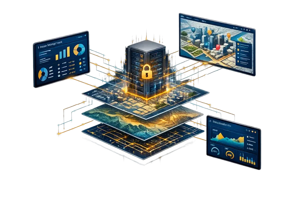
We bring advanced expertise in designing and developing geospatial platforms based on Geographic Information Systems (GIS), enabling organizations to manage their geospatial data within secure and interconnected digital environments. Our solutions ensure system integration, continuous data updates, and scalability aligned with institutional operational requirements.
This integration transforms geospatial data into actionable insights and operational indicators that enhance planning, asset management, project monitoring, and decision-making efficiency across multiple sectors.
Trusted by Authorities and Critical Sectors


Explore the power of GIS and related technologies to support operational efficiency, in-depth analysis, and spatial data management.
We manage and automate geospatial data within a unified environment, ensuring consistent updates, improved accessibility, and efficient data utilization.
We support organizations in the collection and analysis of geospatial data for a wide range of applications, leveraging satellite imagery and aerial data. This enables the monitoring of spatial changes and strengthens planning, monitoring, and data-driven decision-making.
We contribute to the implementation of smart city standards, with a focus on optimizing urban service management and the spatial distribution of services. By leveraging geospatial data and integrated systems, we enhance operational efficiency and support more effective planning, monitoring, and data-driven decision-making.
We design and implement geospatial monitoring systems that enable organizations to track construction sites, urban developments, assets, and projects in real time, ensuring rapid response, accurate oversight.
We deliver advanced digital modeling services to create accurate spatial representations of assets and sites, reflecting real-world conditions. By integrating geospatial data with multiple data sources, our solutions support efficient asset management, monitoring, and informed decision-making.
We apply advanced deep learning models to geospatial data, transforming it into intelligent, actionable insights. Through AI-driven spatial analysis, we support optimal site selection, trend prediction, and performance optimization.
We leverage centralized geospatial databases, advanced analytics platforms, and seamless integration with remote sensing, IoT, and artificial intelligence technologies to deliver a robust and reliable digital operating environment. This enables efficient data flow, high-quality analytics, and rapid access to information across all levels of the organization.

Geographic Information Systems empower organizations to efficiently manage their assets, projects, and geospatial data, supporting long-term planning, improving service quality, and enhancing operational efficiency across multiple sectors.
We present a curated selection of projects leveraging Geographic Information Systems (GIS) to transform geospatial data into operational and analytical tools that support asset management, project monitoring, and efficient decision-making across diverse working environments.
Don’t let your data remain fragmented. Our team of data experts and GIS developers is ready to build your centralized geospatial ecosystem, transforming complex data and maps into intelligent dashboards that give you full control over your projects and assets.