
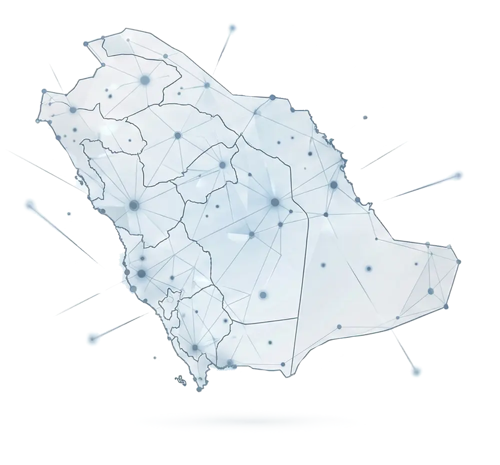
We do more than deliver data. At Alqotr, we harness the power of advanced Geospatial Intelligence to empower our government and private sector partners to make confident decisions built on precise, actionable insights.
At Alqotr, we serve as the bridge between physical reality and the Kingdom’s digital vision. We go beyond the role of a conventional surveying firm to deliver a fully integrated consulting ecosystem that combines precision geospatial solutions, intelligent GIS systems, and comprehensive property asset protection. We uphold precision as our standard, integrity as our principle, and innovation as our approach—empowering Vision 2030 objectives and enabling confident, future-ready strategic decisions.

We transform physical environments into strategic digital assets. By combining the precision of laser scanning with the speed and efficiency of unmanned aerial systems, we deliver highly accurate Digital Twins and BIM models that reflect reality with exceptional clarity ensuring engineering efficiency, infrastructure integrity, and precise documentation of complex assets and facilities.
Comprehensive Surveying Solutions Covering All Engineering Requirements
High-precision land measurements supporting urban planning and infrastructure development in compliance with engineering standards.
High-resolution aerial mapping, volumetric analysis, and rapid monitoring of large-scale projects and territories.
Accurate detection and mapping of subsurface utilities, including cables and pipelines, ensuring infrastructure protection and safety.
High-accuracy 3D models supporting Building Information Modeling (BIM), asset documentation, and architectural analysis.
Transforming field surveys and 3D scans into intelligent digital models supporting design, engineering, and operational workflows.
Advanced reality capture, asset lifecycle tracking, and smart infrastructure data integration to support digital transformation initiatives.
We enable organizations to unlock the full value of their spatial data by designing and implementing integrated GIS platforms and solutions built on centralized geospatial databases. Our systems support advanced analytics, asset management, project monitoring, and data-driven decision-making through high-quality mapping, interactive applications, and enterprise geospatial platforms.
Property studies and real estate registration form the foundation of investment certainty. We combine regulatory expertise with operational excellence to deliver comprehensive solutions in expropriation and Project Management Consultancy (PMC), ensuring rights protection and procedural integrity. Our experienced advisory team provides specialized expertise in.
We support organizations in collecting and analyzing geospatial data using satellite imagery and aerial data, enabling spatial change detection, environmental monitoring, and informed planning and decision-making across multiple sectors.
We support the implementation of smart city standards by enabling efficient urban service management, improving geographic service distribution, and enhancing operational efficiency through integrated geospatial systems and data-driven platforms.
We design and implement spatial monitoring systems that enable real-time tracking of assets, infrastructure, and projects through integrated geospatial data and multi-source system connectivity—ensuring accurate monitoring and rapid response.
We deliver digital modeling services to create accurate spatial representations of assets and environments, enabling efficient asset management, performance monitoring, and integration with multiple geospatial and enterprise data sources.
We apply artificial intelligence technologies to analyze spatial data, identify patterns, and generate actionable insights—empowering organizations to make faster, more accurate, and data-driven decisions.
We deliver a comprehensive consulting ecosystem that integrates engineering expertise with deep regulatory knowledge. Our services include property studies, expropriation management, real estate registration for major development projects, Project Management Consultancy (PMC), and municipal technical support projects. At every stage, we ensure the protection of rights, regulatory compliance, and the highest standards of execution efficiency in accordance with approved regulations.
We conduct comprehensive field and desk research to collect and verify property data, assess actual land use and compliance with approved plans, and accurately identify owners and stakeholders to support project planning and implementation requirements.
We manage and assess expropriation cases for public and development projects, including property identification, ownership verification, compensation assessment, and coordination with relevant authorities to ensure full regulatory compliance and protection of stakeholder rights.
We provide end-to-end project management for geospatial and infrastructure projects, from planning through delivery. Our services include schedule control, cost management, quality assurance, and risk management ensuring successful execution aligned with international best practices.
We deliver comprehensive real estate registration services, including surveying, plan and boundary verification, and coordination with government authorities to complete registration procedures and issue final ownership documentation.
Integrated hydrological and environmental studies leveraging spatial analysis and scientific modeling to support sustainability and effective natural resource management.
We analyze flood risks, surface water behavior, and drainage patterns to support infrastructure planning, risk mitigation, and safe project development.
We assess environmental impacts, evaluate natural resource conditions, and analyze environmental risks to ensure regulatory compliance and support sustainable project development.
We analyze site conditions, constraints, and development opportunities to support informed planning decisions prior to project implementation.
We evaluate the technical and economic viability of projects to minimize risks, optimize investment decisions, and ensure the best possible outcomes.
We provide specialized technical support and operational services for municipal and government geospatial projects, ensuring system continuity, operational efficiency, and data reliability.
We manage enterprise GIS platforms, including performance monitoring, user and access management, system availability assurance, technical issue resolution, and periodic system updates.
Our specialized teams work closely with municipalities and government entities to support geospatial project implementation and operational workflows.
We manage and update spatial layers and base maps through data collection, quality validation, processing, and continuous updates using advanced technologies and multiple data sources.
We design and deliver specialized training programs to build institutional capacity in surveying, GIS, and geospatial data management.
We develop comprehensive operational manuals and methodologies that document technical and operational procedures for managing geospatial systems and data.
We empower national workforce capabilities through structured knowledge transfer programs, including mentoring, collaborative implementation, and hands-on technical training.

We take pride in being a trusted strategic partner in Saudi Vision 2030 projects. Our expertise has contributed to shaping major national developments, including Qiddiya, Diriyah, and NEOM. We value the trust placed in us by our government and private sector partners and are honored to be an active member of the International Federation of Surveyors (FIG).


Whether you are planning a large-scale infrastructure project or seeking reliable asset registration solutions, our team of experts is ready to support you. Build your decisions on precision, confidence, and trusted geospatial intelligence.