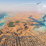



The surveying and topographic mapping sector is undergoing rapid development with the emergence of advanced technologies that enable the collection of large volumes of spatial information within short periods and with high levels of accuracy and detail. Drones and aerial surveying technologies have become important tools for conducting topographic studies and infrastructure projects, particularly at sites that require extensive area coverage or access to locations where conventional surveying methods are difficult to implement.
LiDAR technology, alongside aerial photogrammetry, stands out as one of the advanced solutions for collecting three-dimensional data. Through laser pulses, LiDAR can measure distances between the sensor and the ground surface and objects located on it, generating detailed data that represents the characteristics and physical features of a site.
Combining drones with modern sensors enables surveying activities to be carried out more efficiently, reduces the time required for fieldwork, and improves the level of detail available for a project. This provides owners, consultants, and contractors with more suitable data to support engineering and planning decisions.
From Traditional Surveying to Aerial Data Collection Technologies
For many years, surveying activities relied primarily on direct ground measurements using surveying equipment. While these methods remain essential for many applications, the nature of modern projects and the increasing scale of work sites often require tools capable of covering larger areas in less time.
This is where drone-based aerial surveying plays an important role. It enables data collection from suitable altitudes and allows large areas to be covered without the need to perform every measurement manually and point by point in the field.
This approach helps reduce fieldwork time, increase surveying team productivity, and provide access to areas with challenging terrain. It also generates data that can be processed into a wide range of surveying and engineering products according to project requirements.
Photogrammetry and LiDAR: What Is the Difference?
Aerial Photogrammetry is a technology based on capturing a series of overlapping aerial images of a site and then processing them using specialized techniques to extract engineering information and create three-dimensional models, maps, and topographic products.
LiDAR, on the other hand, relies on transmitting laser pulses and measuring the time it takes for those pulses to return after reflecting off different surfaces. This process enables the collection of a large number of measurement points representing the shape of the site and its features, commonly known as a Point Cloud.
Each method has characteristics that make it suitable for different types of projects. Photogrammetry provides rich visual information and can be used to produce maps, orthophotos, and surface models. LiDAR, meanwhile, is distinguished by its ability to generate highly detailed three-dimensional information. Its data can also be processed to extract the ground surface, including at sites containing various objects or vegetation, depending on the sensor and the data collected.
Therefore, selecting the appropriate technology is not based on a single factor. It depends on the nature of the site, the type of data required, the desired level of detail, and the ultimate purpose of the surveying work.
Drone Surveying in Mountainous and Desert Terrain
The diverse terrain of Saudi Arabia presents an important challenge for surveying projects due to the geographical variation between mountainous and desert areas, valleys, urban environments, and large-scale infrastructure project sites.
Drones provide significant flexibility in dealing with these environments. They can be used to collect data across large areas while reducing the need for field teams to move extensively through difficult or expansive sites.
In mountainous areas, aerial surveying can support the analysis of slopes, elevations, valleys, proposed road alignments, and infrastructure routes. In desert environments, drones can be used to cover extensive areas and produce accurate terrain models that support the assessment of ground elevations, project routes, and site characteristics before design and construction activities begin.
These capabilities become particularly valuable for projects that require regular updates to topographic information or extend across large geographical areas that are difficult to cover using ground-based methods alone.
Transforming Survey Data into 3D Point Clouds
Point Clouds are among the most important outputs of modern surveying technologies. They consist of a massive collection of three-dimensional points representing surfaces and features captured during the surveying process.
Each point may contain spatial information such as coordinates and elevation, in addition to other attributes depending on the type of sensor and data collection methodology.
Point Clouds provide a detailed representation of a site that can be used for numerous applications, including terrain analysis, feature extraction, three-dimensional modeling, structural assessment, quantity calculations, and comparisons between existing conditions and design plans or previous surveys.
The data can also be processed and classified into different categories, such as ground surfaces, structures, and natural features. This enables the extraction of more specialized surveying products based on the specific requirements of the project.
Digital Elevation Models and Their Role in Engineering Projects
One of the important outputs of aerial surveying is the production of Digital Elevation Models (DEM), which represent ground elevations within a defined geographical area.
These models provide an important foundation for various engineering and topographic studies. They can be used to analyze slopes, study water drainage directions, determine road alignments, calculate elevation differences, and support design and planning activities.
Digital Surface Models (DSM) can also be produced to represent the surface of a site, including buildings, structures, and other features. This provides a more comprehensive understanding of the area depending on the purpose of the study.
Therefore, the value of aerial surveying is not limited to collecting images or points. It extends to transforming raw data into digital products that can be directly used in engineering studies and analyses.
Faster Delivery and Reduced Fieldwork Costs
One of the key advantages of modern aerial surveying technologies is their ability to reduce the time required to cover large sites, which is particularly important for projects operating under strict schedules.
Instead of relying entirely on field teams to perform measurements across every part of a site, drones can be used to systematically cover extensive areas and collect data, which can then be processed to generate the required deliverables.
This helps reduce the number of field visits, improve resource allocation, and minimize the time associated with initial measurement activities. It also allows surveys to be repeated when necessary to monitor changes at a site.
This does not mean that aerial technologies eliminate the role of ground surveying. Rather, they enable different surveying methods to be integrated according to project requirements, allowing each technology to be used where it provides the greatest technical and operational value.
Applications of Aerial Surveying in Infrastructure Projects
The applications of drone and LiDAR surveying in infrastructure projects are extensive, ranging from preliminary site studies to construction monitoring and verification of existing conditions.
The resulting data can be used for roads and bridges, grading works, utility networks, urban development projects, construction sites, energy projects, topographic studies, and site change monitoring.
Repeated surveys also enable comparisons between data collected at different points in time. This helps project teams monitor progress, identify variations, and document actual site conditions more clearly.
These capabilities provide engineers, consultants, and project managers with a rich source of information that can be integrated with the design, analysis, and geospatial systems used throughout the project.
Why Have Drone and LiDAR Technologies Become Important for Saudi Projects?
With the expansion of infrastructure and urban development projects across the Kingdom, the need for accurate and frequently updated topographic data has become more important than ever.
Aerial surveying technologies provide an effective way to address large and diverse sites by combining rapid area coverage, high data density, and the ability to produce multiple-purpose digital models.
These advantages help reduce the time required to obtain field information, improve the quality of inputs used during design and planning stages, and minimize risks associated with insufficient or outdated data. Ultimately, this contributes to greater project execution efficiency and more effective resource management.
Alqotr… Advanced Expertise in Aerial Surveying and 3D Spatial Data
Alqotr utilizes aerial surveying, drone, and LiDAR technologies to provide advanced solutions for collecting and processing spatial data across different types of projects and sites.
The company’s services include aerial surveys, Point Cloud generation, Digital Elevation Models, Digital Surface Models, and topographic products, in addition to processing data and transforming it into outputs that can support engineering studies, planning activities, and infrastructure projects.
The company also combines Photogrammetry and LiDAR laser scanning technologies according to the nature and requirements of each project. This enables the selection of the most appropriate methodology based on the required level of detail, coverage area, terrain characteristics, and desired deliverables.
By leveraging modern technologies and specialized expertise in geospatial data processing, Alqotr provides accurate spatial information that helps clients better understand their sites, accelerate study phases, improve the quality of engineering decisions, and enhance project execution efficiency.
The company continues to develop its capabilities in aerial surveying and three-dimensional data to meet the growing needs of projects across the Kingdom and support the transition toward more efficient and accurate approaches to surveying, topographic mapping, and infrastructure projects.