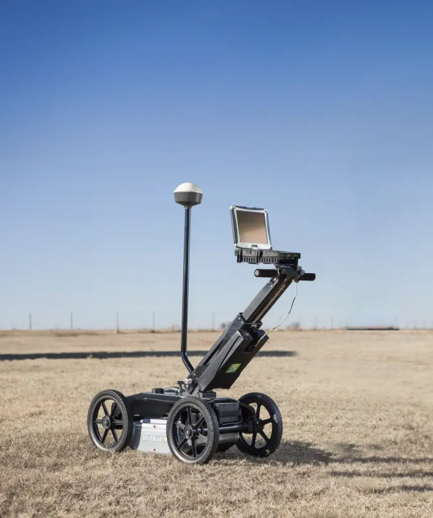
Ground Penetrating Radar (GPR) is highly effective in locating and distinguishing a diverse range of materials, both metallic and non-metallic. Its efficacy is optimized when there exists a significant contrast in the electromagnetic properties of the materials under survey. Metallic objects, such as reinforcement within concrete structures, are particularly favourable targets for detection.
Our services:
Metallic objects: Metal reinforcement in concrete, buried pipes, underground storage tanks, and anything made of metal.
Concrete structures: Voids, cracks, delamination, rebar spacing, and thickness variations in concrete structures such as bridges, pavements, and buildings.
Soil variations: Changes in soil density, moisture content, and compaction, which can indicate underground features like voids, tunnels, or buried objects.
Rock and bedrock features: Fractures, voids.
Utilities: Underground cables (e.g., electrical, communication), water mains, sewer lines, and drainage systems made of various materials.
Environmental hazards: Underground storage tanks, contaminants, and waste materials that can pose environmental risks.
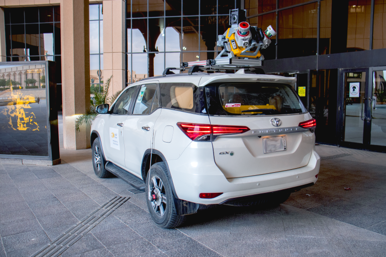
Mobile Mapping Solution is capturing high resolution data from street-level for Large-Scale Scanning and Mapping Missions, Delivering Data Confidence, Precision and High Efficiency of all visible assets. Mobile Mapping technology capturing dense LiDAR data along with 360° high resolution georeferenced images using of sophisticated 360° high resolution optical camera systems in combination with LiDAR data acquisition sensors that can be mounted on vehicle. Our services:
Road, Railways, Pipelines corridor survey and management
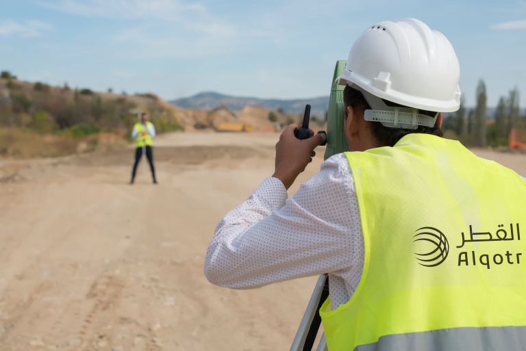
Alqotr company offers specialized services in the field of land surveying and terrain analysis, aiming to provide accurate and comprehensive information to meet the needs of our clients in various sectors. We care about the field data collection through a distinguished team of engineers, surveyors, and technicians who are trained exceptionally and have extensive experience in this field. Alqotr Company relies on the latest surveying technologies and advanced tools to ensure the execution of land surveying projects with the highest levels of accuracy and efficiency.
Our services:
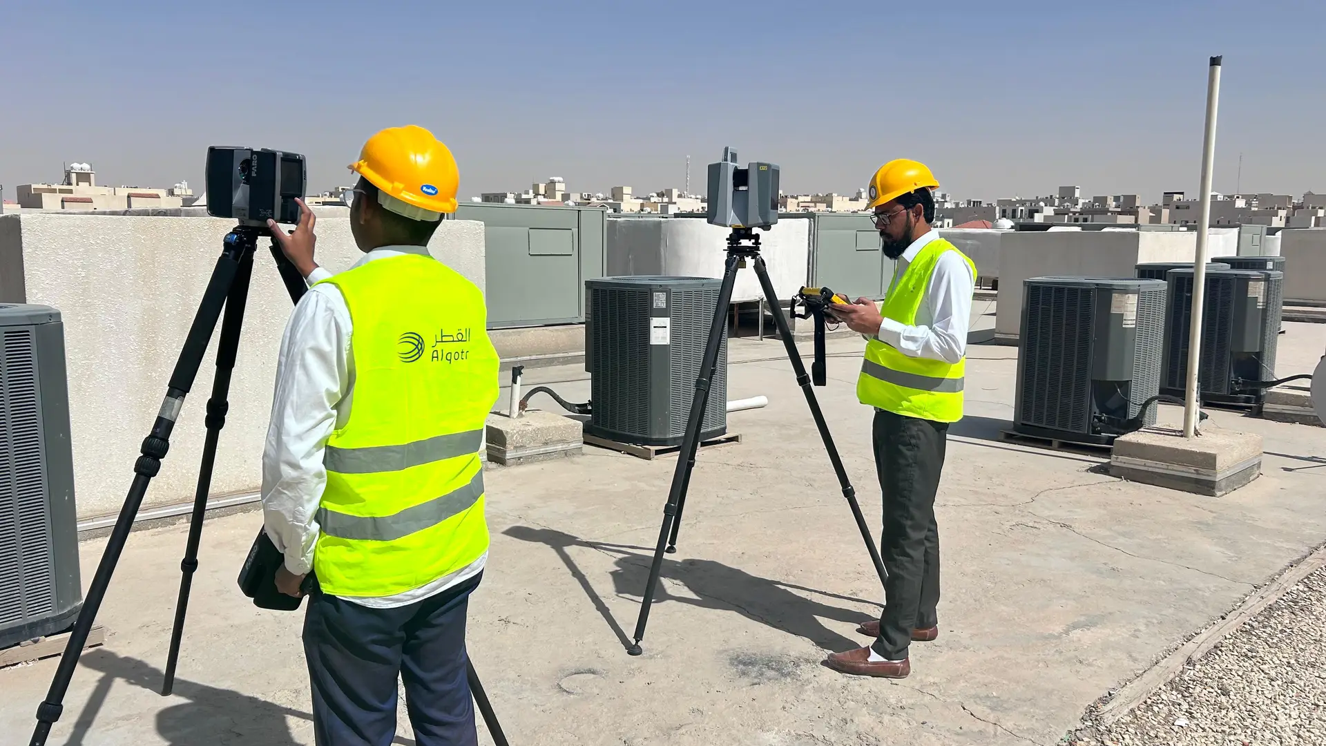
Laser scanning is a highly accurate non-contact, non-destructive digital technology that captures the 3D geometry of a physical object. 3D laser scanners capture highly accurate 3D digital representations of features as a real texture point cloud. We in Alqotr helping clients to successfully complete their projects with accurate as-built documentation. Delivering the highest quality point cloud data, 2D-3D CAD drawings and BIM using state-of-the-art equipment, technology and processes. Our services:
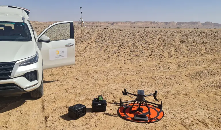
Aerial mapping is capturing, collecting, analyzing data from an aerial perspective, typically using unmanned aircraft systems (UAS) such as drones or any other aerial methods and aerial craft equipped with cameras or other imaging sensors, by capturing a series of overlapping images from different altitudes and angles. These images are then stitched together using aerial software and photogrammetry to create a detailed map or 3D model of the area. Our services: