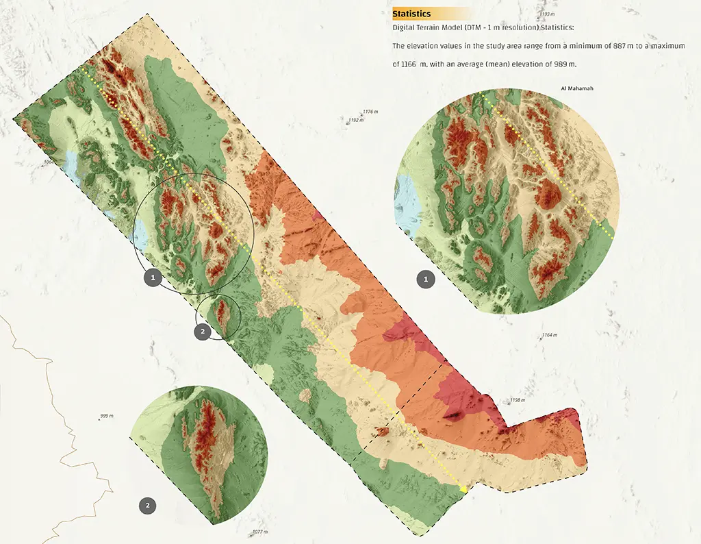
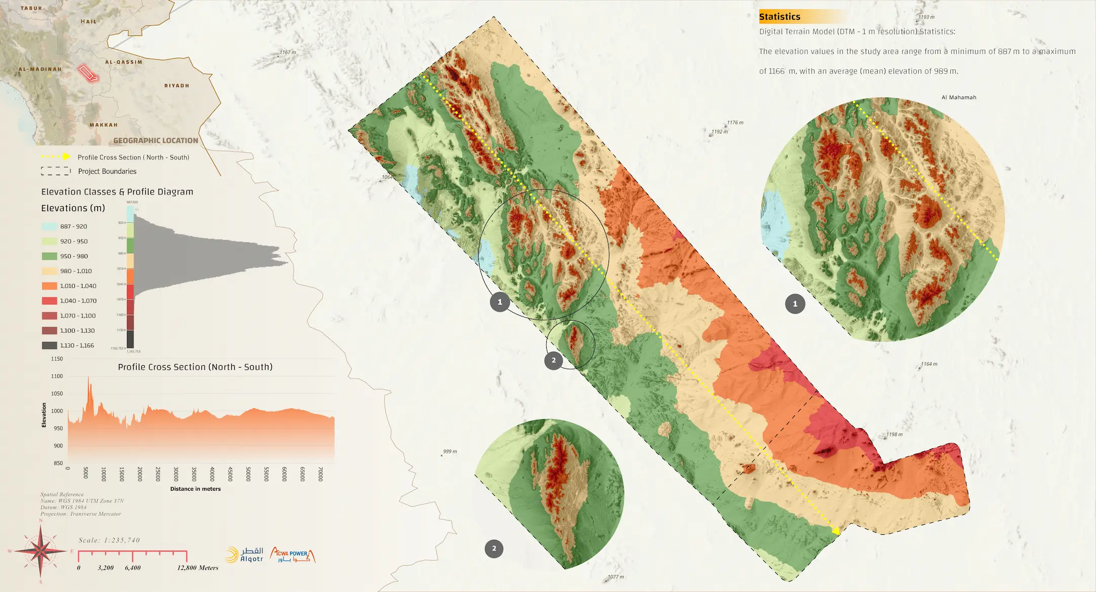
Unmanned Aerial Vehicle (UAV/Drone) mapping covering an expansive area of 1,350 km². The project delivered highly accurate topographic maps, Digital Terrain and Surface Models (DTM/DSM), and orthophotos. These outputs were subsequently utilized to conduct hydrological studies, environmental impact assessments, and pre-design evaluations to determine the site’s suitability for its intended purpose.
