Services
Geospatial Services and Solutions
Geographic Information Systems (GIS)
Cadastral and land ownership studies
Hydrological and Environmental Studies
Operations and Technical Support
Portfolio
about us
Partners & Accreditations
Supporting 2030 Vision
Chairman Message
Knowledge Center
News & Events
Articles and Insights
Conferences & Exhibitions
career
Contact Us
English
العربية
English
X
Project
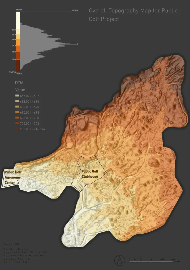
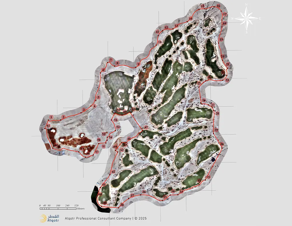
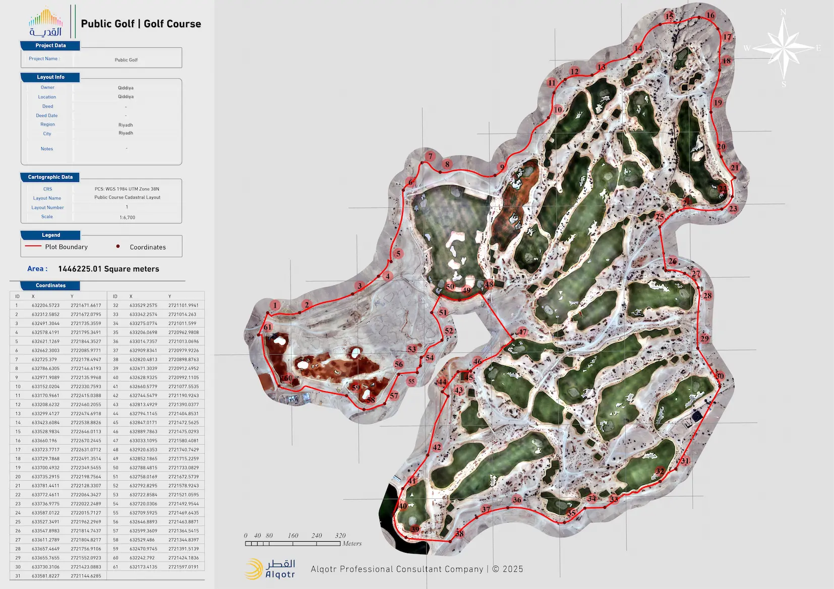
Topographic Survey – Golf Course, Qiddiya
Project Overview
Drone-based topographic surveying for the golf course in Qiddiya Entertainment City.
Project Images
More Projects
Surveying Works for Updating Geospatial Databases – Phase IV, Jeddah Municipality
Surveying Works for Updating Geospatial Databases – Phase IV, Jeddah Municipality
Topographic Survey – Golf Course, Qiddiya
Drone-based topographic surveying for the golf course in Qiddiya Entertainment City.
Operation and Maintenance of the GIS Center – Jeddah Municipality
Operation and maintenance of an integrated GIS ecosystem to ensure spatial data continuity, optimize performance, and enhance application integration to support corporate efficiency.
Operation and Maintenance of GIS – Zakat, Tax and Customs Authority (ZATCA)
Operation and maintenance of the GIS ecosystem to support service efficiency and enhance spatial data management within a stable, integrated environment.
Hydrological Risk Assessment & Flood Mitigation Planning – Hail Municipality
Development of a flood risk management master plan and hydrological solutions to mitigate stormwater and flood hazards across Hail Municipality and its affiliated municipalities, supporting resilient and sustainable urban development.
Hydrological Study for 8 Land Deeds in Al-Hair
Hydrological study for 8 land deeds in Al-Hair, covering an area of 13 km², including the design of hydrological solutions for flood risk mitigation within the project scope.
error:
المحتوى محمي بحقوق الملكية الفكرية!
