
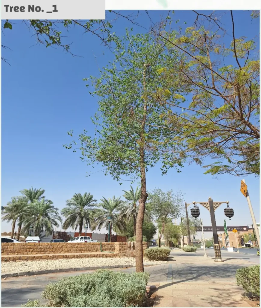
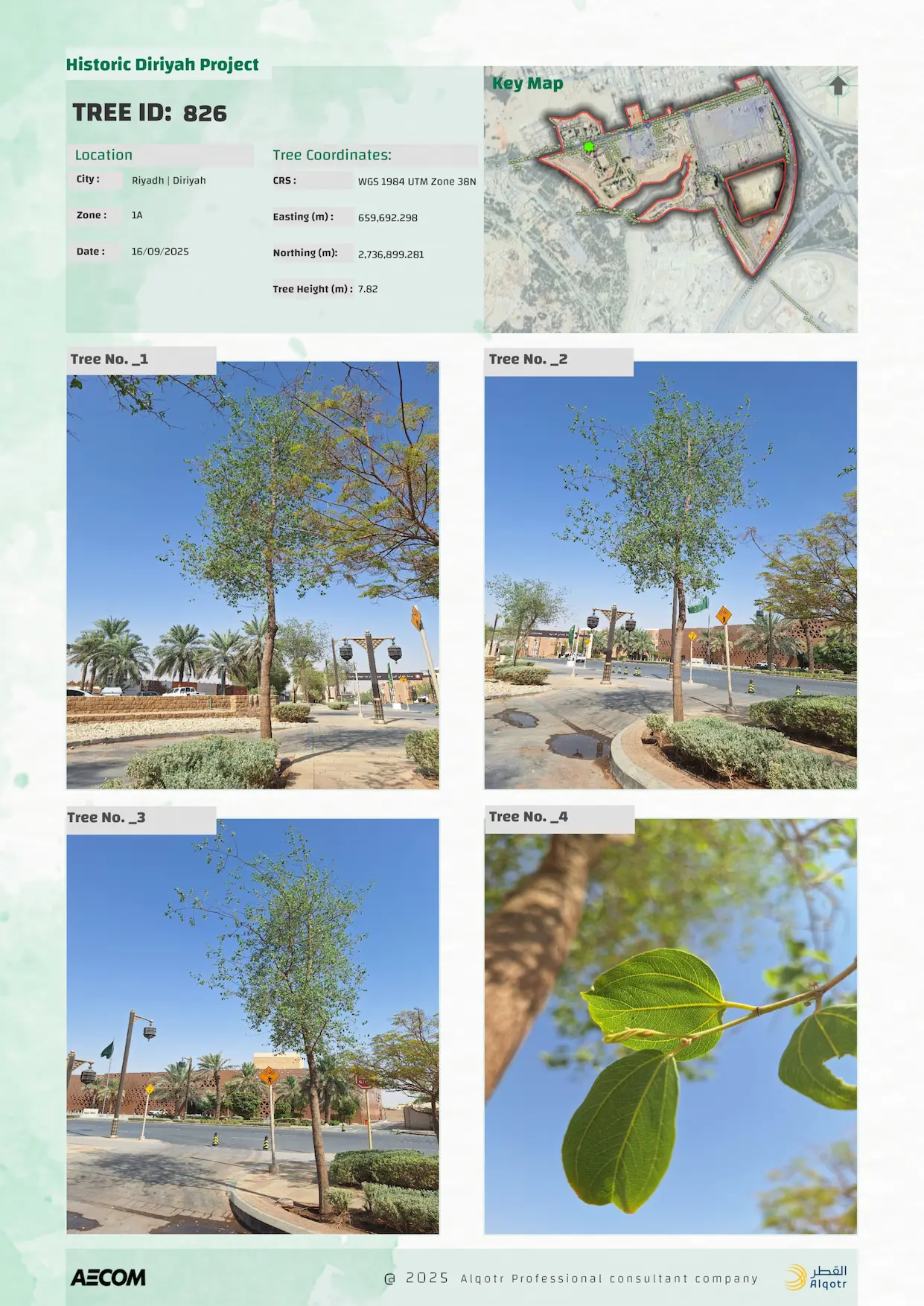
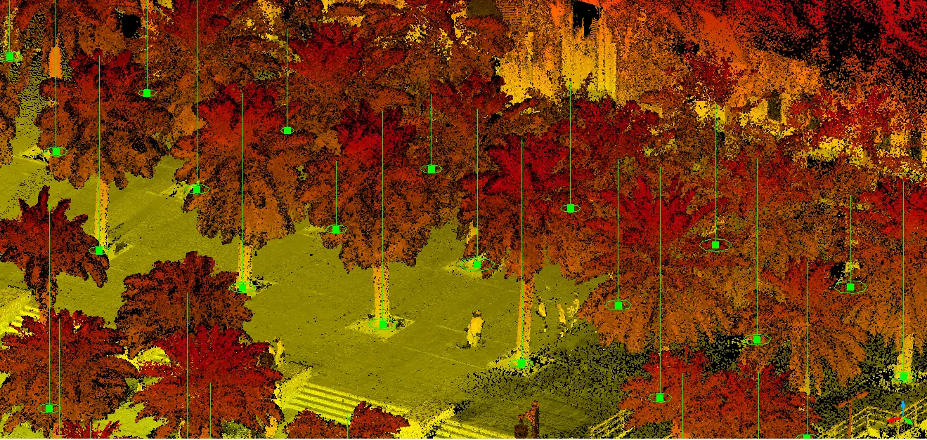
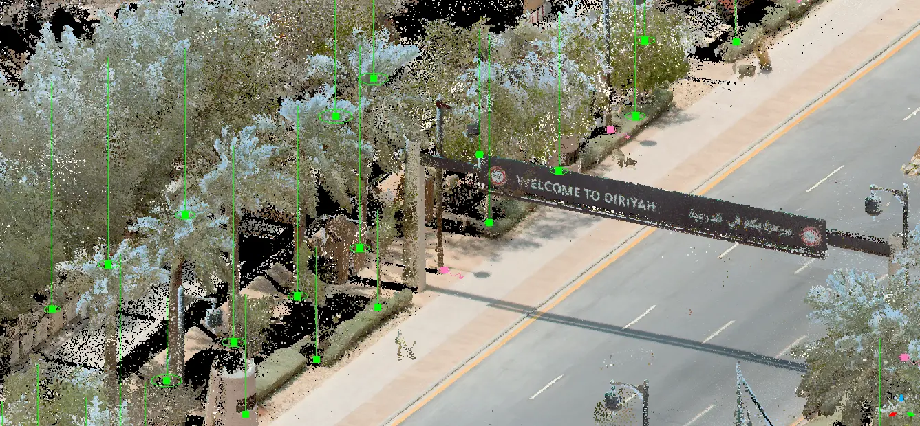
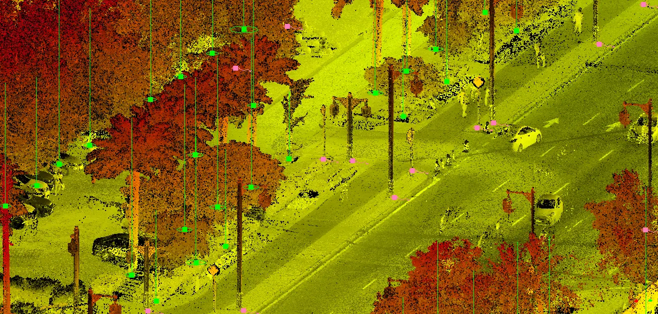
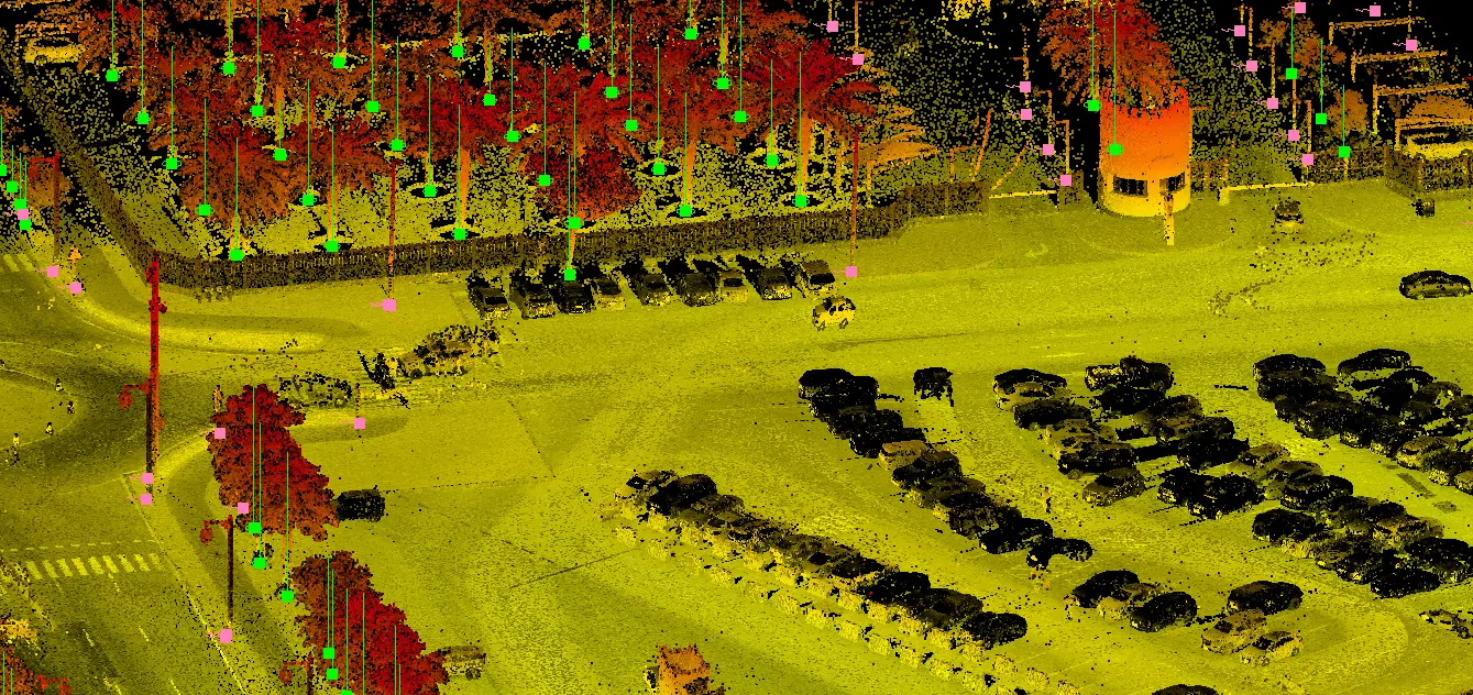
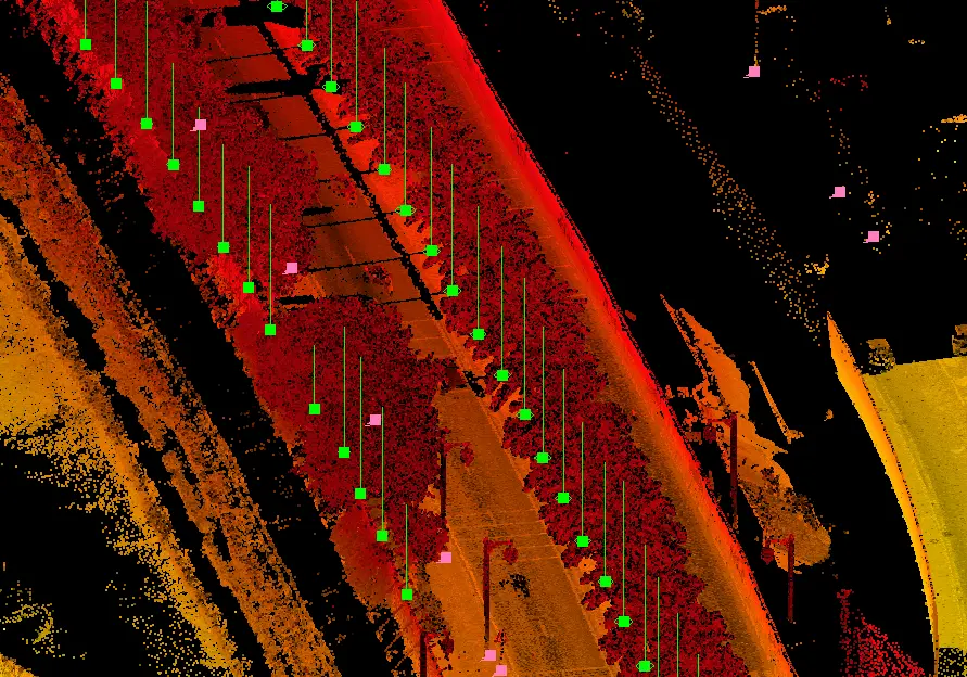
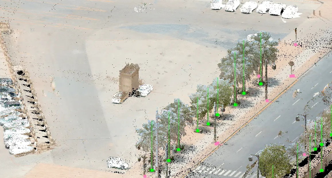
Advanced mobile mapping systems were used to carry out detailed tree surveys across Historic Diriyah, enabling precise identification of tree locations, species, and heights. Each tree was further documented through a comprehensive profile, including high-resolution imagery of trunks, leaves, flowers, and fruits, ensuring a complete and accurate vegetation record.