

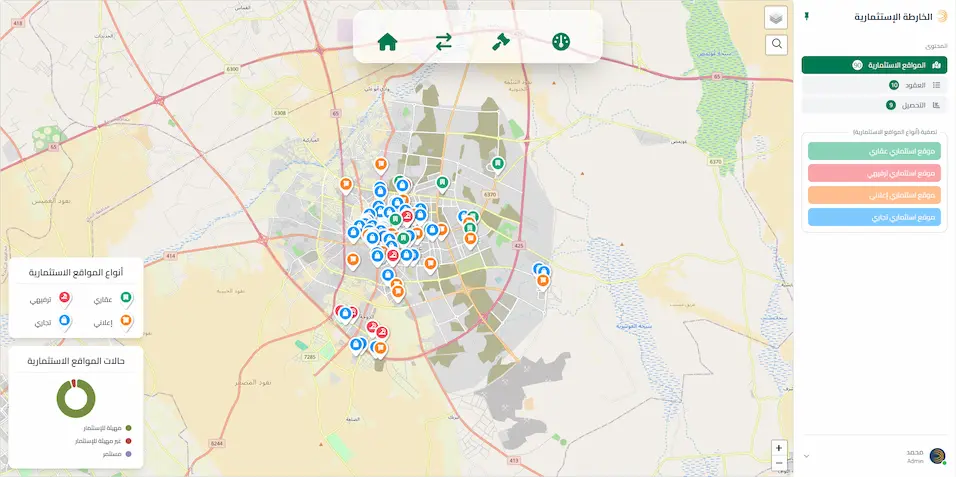
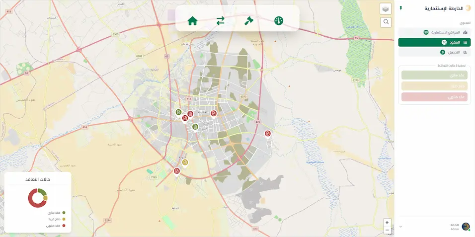
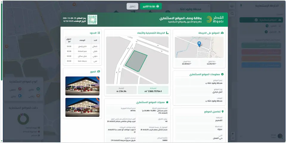
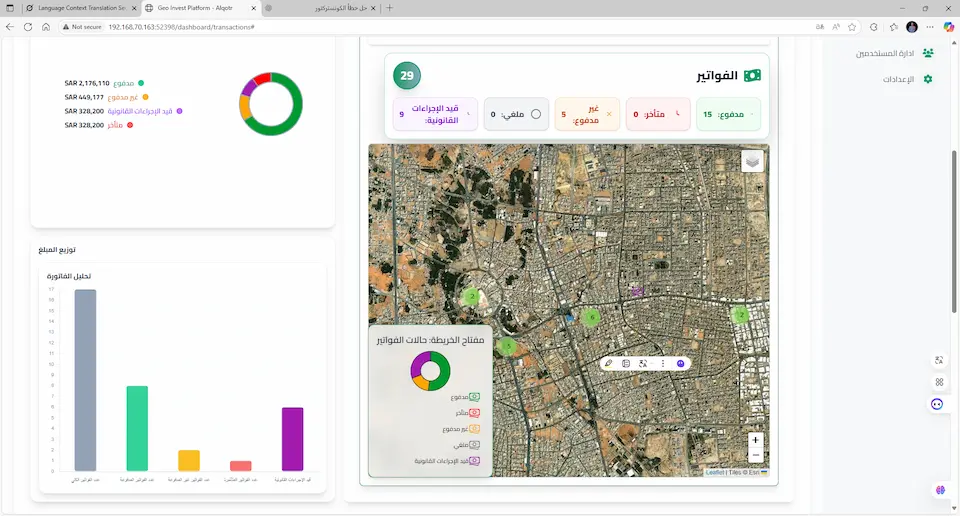
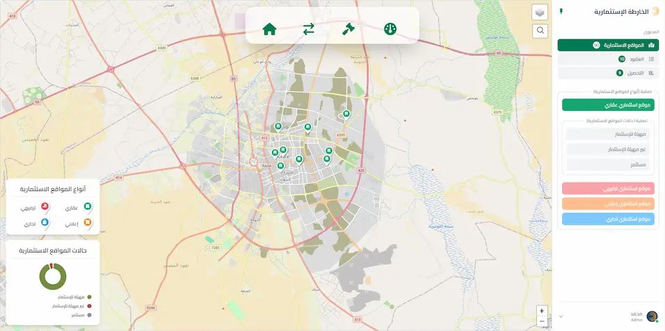
The “Geo-Invest” project delivers an integrated geospatial platform designed to manage municipal assets and investments by seamlessly linking spatial data with financial and operational records within a unified analytical environment. The project focuses on the precise inventory and documentation of assets, associating them with active contracts and revenue collections. It provides robust spatial analysis tools, such as interactive investment maps, to support opportunity assessments and strategic decision-making. The platform enhances administrative efficiency, promotes transparency and governance, and supports integration with relevant systems to achieve operational and financial sustainability.